Vintage New York Postcards, Part 1. The first time I saw vintage postcards of the famous skyscrapers of New York was in Rem Koolhaas’ book Delirious New York, A Retroactive Manifesto for Manhattan. Written in 1978, the content was breathtaking in its idiosyncratic way of writing on the emerging metropolis. Beyond the beautiful Sandborn map featured on the inside of the cover, I was enamored with Koolhaas’ inclusion of many iconographic images of old postcards documenting historical NYC buildings. Later, after living in the Big Apple while a student of architecture, I started collecting those picture postcards, which ultimately developed into a serious hobby, which has a name: Deltiology.
As my collection of vintage cards grew, I started to study them carefully by comparing and contrasting similar subject matters printed at different time periods and by different publishers. One of my favorite past-times developed: the research of how the city, in particular NYC, was represented as it changed and grew vertically.
NYC Public Library
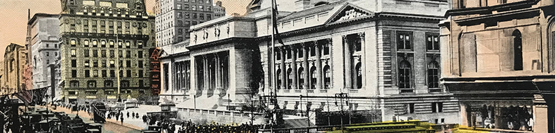
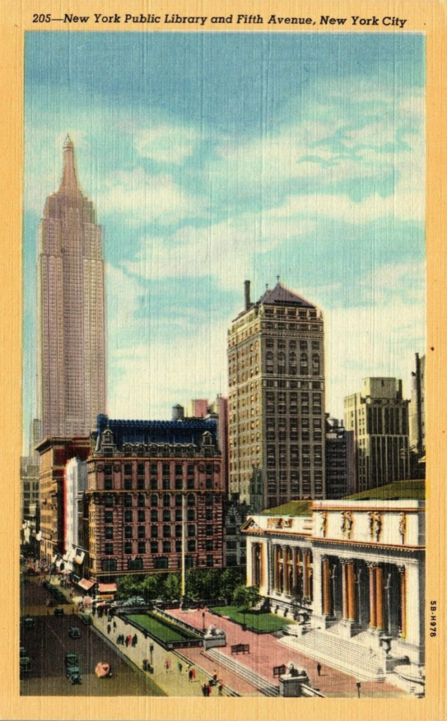
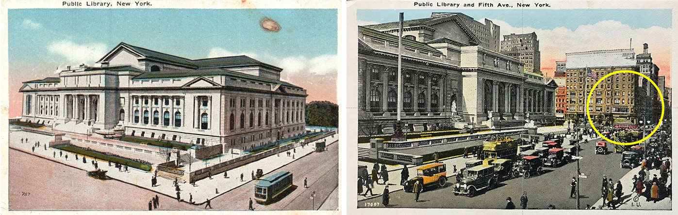
One day, a series of postcards drew my attention to the main branch of the public library on Bryant Park, a landmark building located on Fifth Avenue between 41st and 42nd street. I will admit that it was not because of its Beaux-Arts style, nor because of its design by famed architectural firm Carrère and Hastings, nor because of its function as a repository of books, but more for autobiographical reasons. The image that drew my attention is dated 1925 (stamp post mark), and features a skyscraper immediately south of the library (Images 1 and 2 above, red circle).
(Added 01.16.2022)
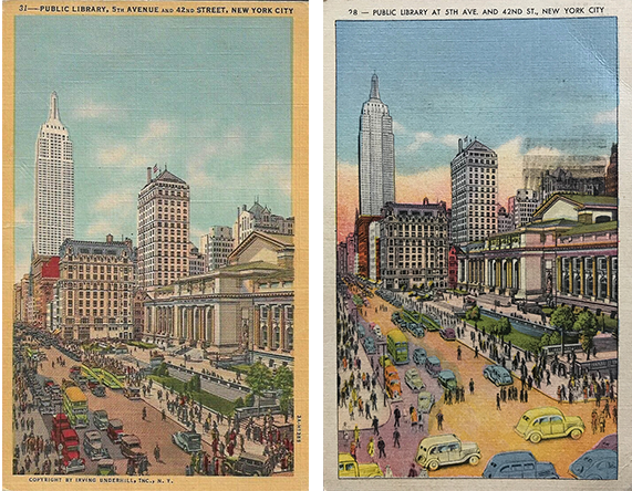
I immediately recognized that this was the place where I attended school my first time in the US. I remembered being in the non-descript penthouse perfectly suited for classrooms, in awe of the vistas of midtown and the night skyscape that were so magical for a young European now living in the Big Apple. The printed description on the back of the card mentioned “Busiest crossing in the city where traffic is heavy at all hours of the day and night…” How true was that statement still in the mid-eighties.
The Institute of Architecture and Urban Studies
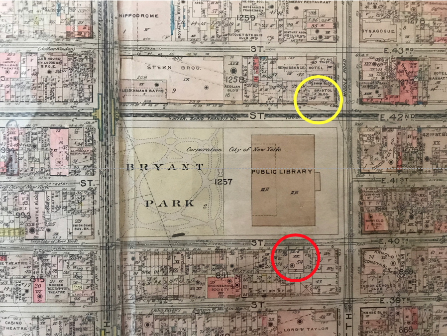
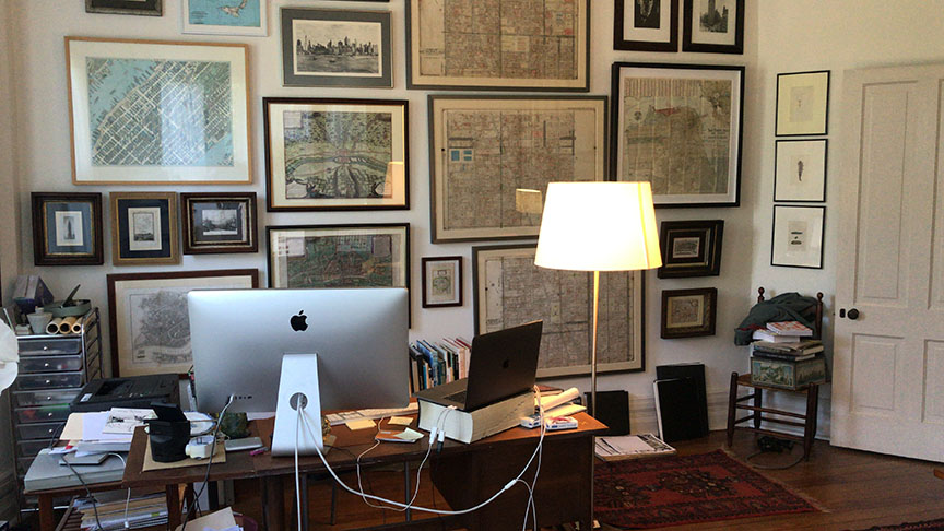
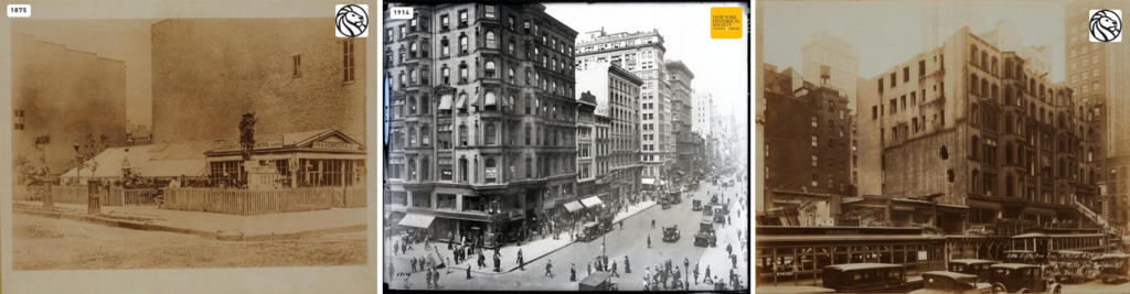
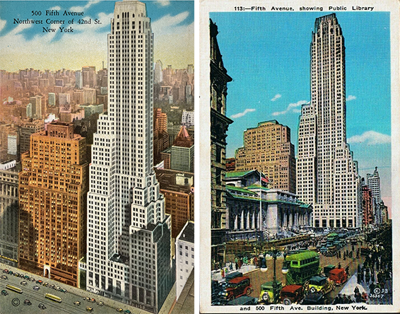
Today, on my home office wall I have a number of maps, a testament to my expanded interest in the imagery of the city (Image 6 above). Included among them are three 1915 Sanborn maps (large maps to the middle right). Lo and behold, that same building, the subject of many fond memories is there (Image 1, red circle) —20 stories high at 8 West 40th street. The identical address of the Institute for Architecture and Urban Studies (I.A.U.S). But wait, on there Sanborn maps, where was the Empire State Building south towards downtown on 34th Street and Fifth Avenue? Missing of course, since it was completed only in 1931. I searched my vintage postcard collection and discovered two postcards (Image 4, above, dated 1934 and 1941) where the iconic building was featured in all of its glory.
While the panorama of that part of the cityscape registered few changes in less than a decade (much had changed above 42nd street during those years), at closer look, a number of particularities drew my attention.
Comparing postcards
(Image 4, above) While both images were drawn from an identical photographic vantage point, the 1934 postcard (to the left) featured a precise rendering of the buildings, vehicles and pedestrian movement. Colors were muted and the scene offered a sense of visual coherence. The second image, dated 1941 (to the right), was over-the-top in its late afternoon rendering, bleeding the sunset colors onto the street pavement. Although more cartoon like in its overall atmosphere, even more remarkable was the introduction in the forefront of caricature-like taxis. At closer look, they are the famous New York yellow checker cabs.
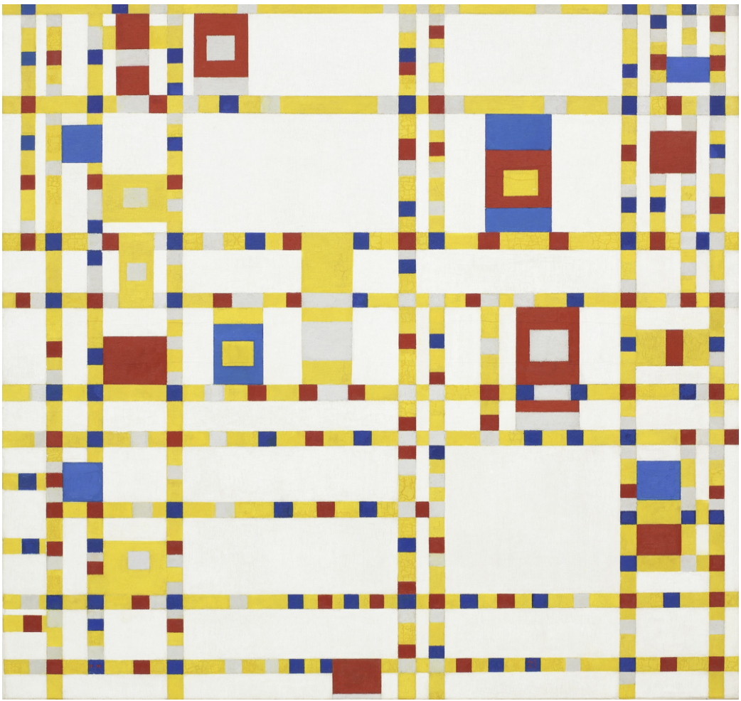
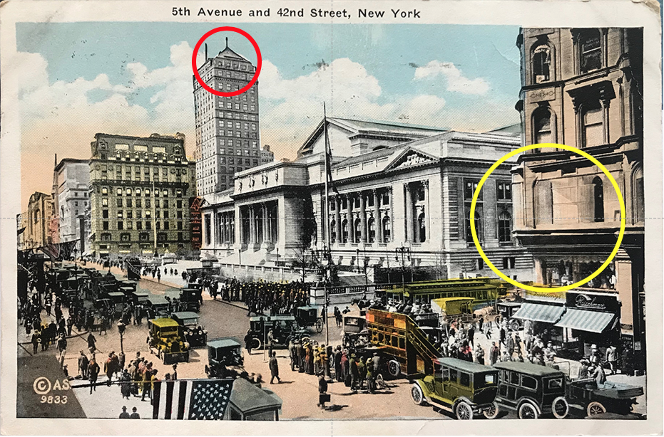
They add a familiarity to the scene and remind me of Piet Mondrian’s 1942-43 painting Broadway Boogie Woogie (Image 7, above), which suggests, in its abstraction, the pulse of the city in all of its artistic dimensions. But what about the changes Uptown? What a contrast between the 1912 view (to the left) (Image 8, below) of the library depicted as an isolated monument and the 1925 view (Image 8, to the right) that shows the library surrounded by larger buildings to the north. Immediately adjacent to the library, is the Bristol Building (yellow circle) located at the intersection of 42nd Street and Fifth Avenue (this is equally recorded on the 1925 postcard and the 1915 Sanborn map, Image 1 above).
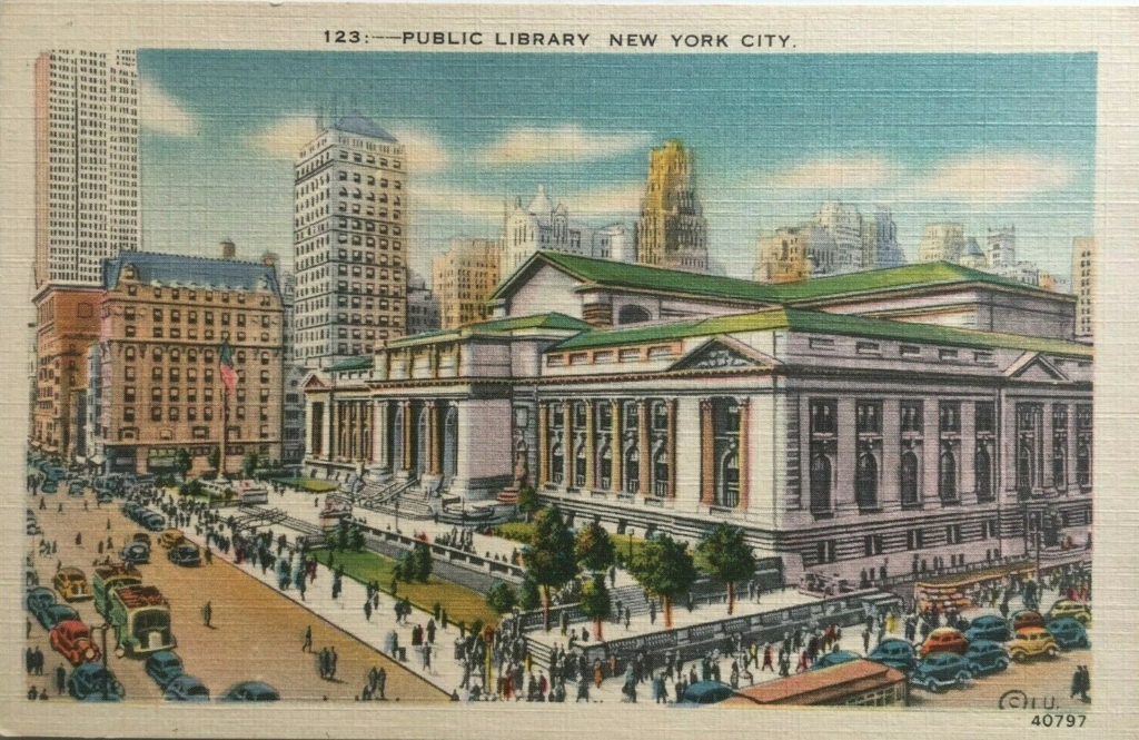
And yet in this 1925 image (Image 9 above, right and Image 10, below), nothing in the urban fabric suggests the repercussions of the 1916 Zoning Resolution -“first citywide zoning code in the United States” enacted after the Equitable Building of 1915. The area of Wall Street (downtown area) had become, due to the profusion of skyscrapers, a series of canyons of shadows with little direct sunlight reaching the streets, thus the vision to enact a new zoning law that required set-backs for all future Highrise buildings on the island of Manhattan. Despite the great depression of 1929, New York City grew rapidly into the 20th century imagery of Gotham City, a nickname for the metropolis of tomorrow with associations of Gothic architecture and, of course, the famous Batman comic books that emphasized the city’s dramatic and dark ambiance.
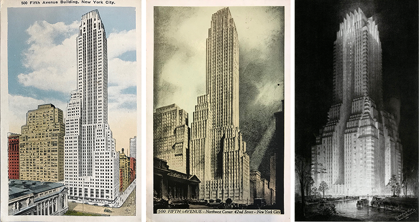
The replacement of the Bristol Building in 1931 (architects Shreve, Lamb & Hamon) saw the completion of the Art Deco Style “500 Fifth Avenue Building. New York’s newest and largest office buildings, with 58 stories high… containing more than 1000 windows overlooking the Public Library and Bryant Park.” Souvenir postcards were quick to represent those changes and further paralleled the artistry of one of its most famous illustrator and architect Hugh Ferris (Image 11 right above). The modern life of urban workers was at the heart of the city’s progress.
Piet Mondrian, Dutch, (1872-1944) -1942-43, Broadway Boogie Woogie, oil on canvas, Museum of Modern Art, MoMA in New York City, NY. (From Google Images)
Conclusion
Vintage New York Postcards, Part 1 is an attempt to elucidate how postcards can be an integral part of a research project, and a way of seeing the past by comparing and contrasting with the present.
Additional blogs on design issues
- Antique primitive sideboards
- Miniature diecast airplanes
- Antique carpet stretchers
- Swiss white wine glasses
- About watches and their typefaces
- A compass set
- Harrods mid-century cocktail cabinet
- Lower deck lavatory: A340-600
- Mortician embalming cooling table
- Urban Posters in Paris, France
- Overnight sleeper train
- Post office Box Cabinet
- Secretaire a abattant
- Tri-fold mirror
- Vintage New York Postcards: Part 2
- New York vintage traffic signals
- About miniature metal buildings
- New York vintage traffic signals